Description
Details
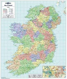
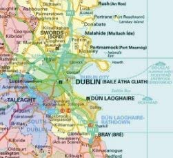
Laminated Wall Map Of Ireland, Laminated Large Wall Map, 84cm x 100cm, Perfect for Schools Offices and Businesses: In Ulster both County and Province boundaries are marked and named to include the county changes that came into effect in April 2015. Major railway lines, ferry routes and rivers are also shown. City centre street insets are included for Dublin Belfast and Cork.
Key features
- In Ulster both County and Province boundaries are marked and named to include the county changes that came into effect in April 2015
- Major railway lines, ferry routes and rivers are also shown. City centre street insets are included for Dublin Belfast and Cork
- Information concerning physical features, population, surface area and currency is shown in an inset box. An ideal map for either business or leisure use in Ireland
- Colour: full color
- Size: 1
Product specifics
- Brand: Map Marketing
- Category: Curriculum Resources
- Size: 1
- Colour: full color
- Model: IRE
- Part number: IRE