Birmingham Postcode Map – Laminated City Centre Sector Wall Map 2

$0.00

  • Make sure this fits by entering your model number.
  • Size: 117 x 96 cm (46 x 37 inches). Scale: 1:10 000.
  • Geographical Coverage Guide – North: Handsworth South: Selly Oak East: Lea Hall West: Hilltop
  • The Birmingham City Sector Map shows the first part of the Postcode and the first number of the second part, or Inward Code.
  • The map is part of a range of postcode city centre maps, the range includes: Bristol, Cardiff, Birmingham, London, Liverpool, Manchester, Leeds, Newcastle, Glasgow and Edinburgh.
  • This map is permanently bonded between two sheets of tough, flexible, crystal-clear plastic.

Out of stock

  • International Express shipping available
  • 30 day easy returns
Guaranteed Safe Checkout

Description

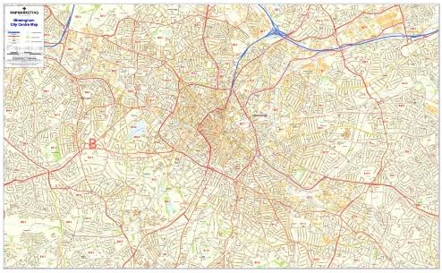
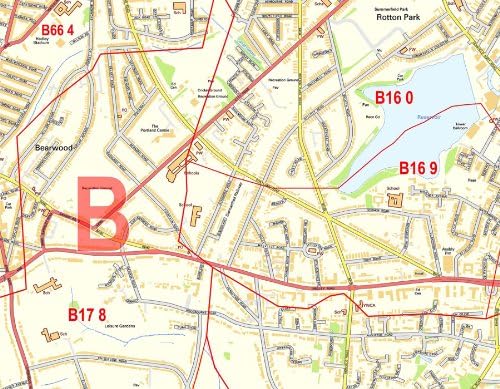
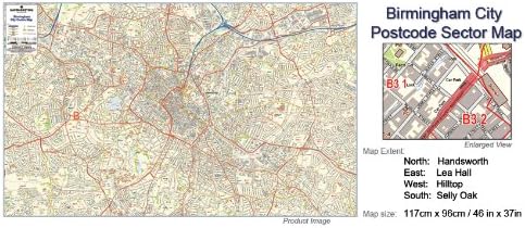
Postcode City Sector Map of Birmingham Size: 117 x 96 cm (46 x 37 inches) Scale: 1: 10 000 Geographical Coverage Guide North: Handsworth South: Selly Oak East: Lea Hall West: Hilltop The Map Marketing City Sector Map series combines highly detailed street level mapping with the first part of the Postcode and the first number of the second part, or Inward Code. Ideal for detailed planning of delivery routes or catchment areas, the Birmingham City Postcode Sector Map include all of the Postcode changes from the most recent Royal Mail Postcode Update. This Postcode Map uses Ordnance Survey street mapping that has been specially coloured to highlight the postcodes. On the map the Postcode Area, District & Sector boundaries and names appear prominently in red.

Additional information

Weight 0.7178 kg
brand

Visit the Map Marketing Store

dimensions

117 x 0.1 x 96 cm; 600 Grams