Description
Details
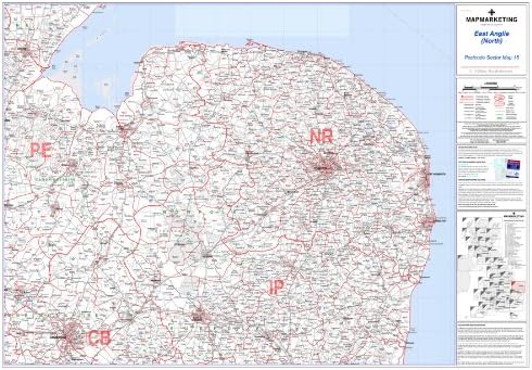
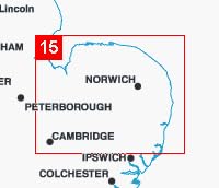
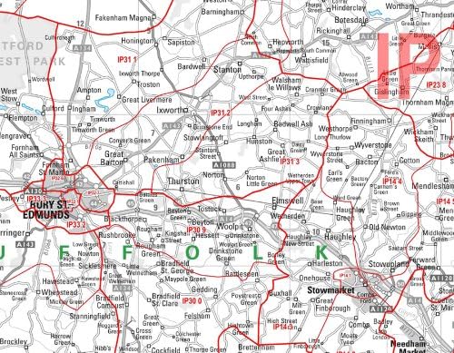
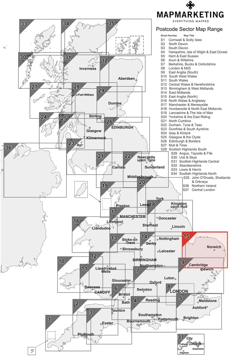
East Anglia, Postcode Sector Map 15, Wall Map With Motorway, A' Roads, B' Roads, City Plans, Area, District: 🔎 This map features detailed information about motorways, 'A' roads, 'B' roads down to unclassified roads, as well as area, sector, district, county and unitary authority boundaries. 🗺️ This map covers East Anglia ( North ) North: The Wash – South: Stowmarket – East: useful Yarmouth – West: Cambridge.
Key features
- 🔎 This map features detailed information about motorways, 'A' roads, 'B' roads down to unclassified roads, as well as area, sector, district, county and unitary authority boundaries
- 🗺️ This map covers East Anglia ( North ) North: The Wash – South: Stowmarket – East: useful Yarmouth – West: Cambridge
- Suitable for maps use
- Material: Laminated
- Colour: Clear
Product specifics
- Brand: Map Marketing
- Category: Maps
- Colour: Clear
- Material: Laminated
- Model: S15
- Part number: S15