
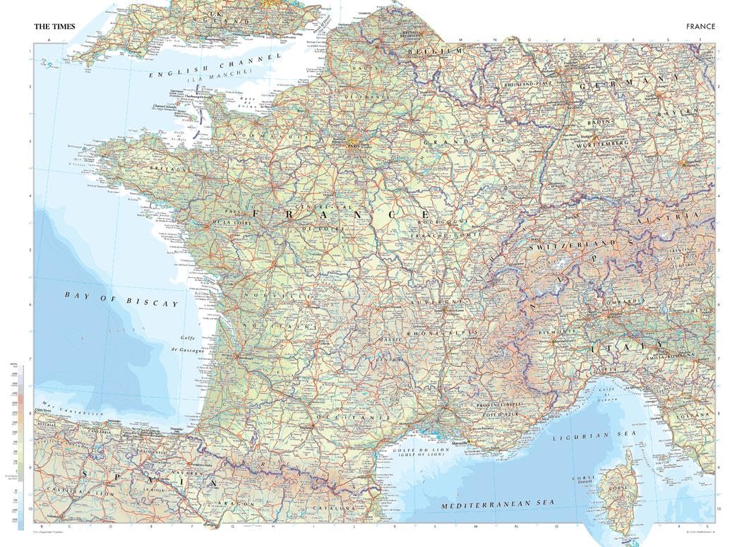
The Times Atlas: France – Compact – 56 x 41 cm Poster – Front Lamination

$87.99

  • TRUSTED PUBLISHER: The Times are a world leader in the publishing industry and are one of the most recognizable brands around the globe. This map is taken from The Times Comprehensive Atlas of the World, which is regarded as the worlds most prestigious and authoritative source of atlases and maps.
  • STYLISH CARTOGRAPHY: These beautiful natural colors help to highlight the physical features, making this perfect a perfect look for the classroom, home or boardroom.
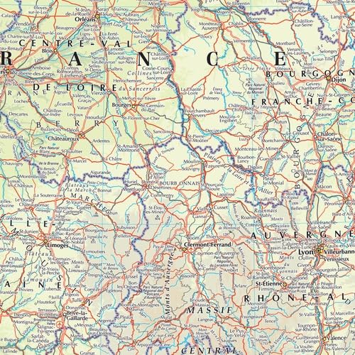
  • MAJOR FEATURES: Map details include detailed road and highway networks, international borders, water depth, distance above/below sea level, and more!
  • HIGH QUALITY PRINT: Your laminated map has a glossy finish so that you can use dry erase markers on the map to highlight features, make plans, and share unique information with others. Lamination is also extremely durable, resistant to folding or ripping. Your map is rolled and packaged in a sturdy tube to protect it during shipment.
  • ROLLED IN A STURDY TUBE: Your map is rolled and packaged in a sturdy tube to protect it during shipment

Out of stock

  • International Express shipping available
  • 30 day easy returns
Guaranteed Safe Checkout

Description

This map of France is a benchmark of cartographic excellence, taken from the industry leading Times Comprehensive Atlas of the World. There is a high level of detail packed into the map, yet the positioning of every element is carefully chosen to make the map coherent and attractive. Major cities including Lyon and Marseille are easily identifiable, as is the capital, Paris. International borders are clearly marked as are regional boundaries within France. Supplementary mapping covers Switzerland, northern Italy, Spain, western Germany and southern England. The island region of Corse (Corsica) is also fully visible. Geographical features such as the Alps and the Pyrenees Mountain range are also marked. Page Size: 22.25 x 16.25 in (561 x 410 mm)

Your laminated map has a glossy finish so that you can use dry erase markers on the map to highlight features, make plans, and share unique information with others. Lamination is also extremely durable, resistant to folding or ripping. Your map is rolled and packaged in a sturdy tube to protect it during shipment.

Additional information

Weight 0.3 kg
Brand

MapSherpa

EAN

0697942195286

UPC

697942195286