


Description
Details
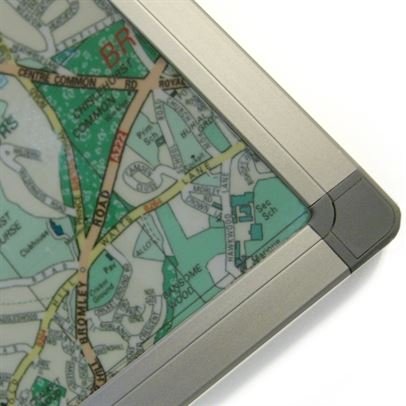
UK Postcode Wall Map, Laminated Large Wall Map, 120cm X 83cm, Clearly Shows Postcode, County And District Boundaries: This Huge Map Is Bonded Between Two Sheets Of Crystal Clear Plastic And Framed In Aluminum. suitable for Offices Businesses Schools And Homes. This Map Shows All UK Postcodes Including Northern Ireland, Scotland And Wales, Up-to Date County, District And Unitary Authority Boundaries.
Key features
- This Huge Map Is Bonded Between Two Sheets Of Crystal Clear Plastic And Framed In Aluminum. suitable for Offices Businesses Schools And Homes
- This Map Shows All UK Postcodes Including Northern Ireland, Scotland And Wales, Up-to Date County, District And Unitary Authority Boundaries
- Suitable For Business Planning This Map Includes Motorways, Motorway Junction Markers, Primary Roads, Town And City Stamps
- Material: Laminated With Aluminum Frame
- Colour: Black
Product specifics
- Brand: Map Marketing
- Category: Educational Charts & Posters
- Colour: Black
- Material: Laminated With Aluminum Frame
- Part number: BIPA